The use of the “Quasi-Zenith Satellite System MICHIBIKI” for positioning is a development that will enable unique research by YRP Ubiquitous Networking Laboratory (YRP UNL) on location-based service (LBS) that uses calibrated location, including indoor positioning, to be used in a wide range of outdoor locations. YRP UNL has cooperated with the Quasi-Zenith Satellite working group (WG) of TRON Forum in research and development for location measurement using “MICHIBIKI.”
“Quasi-Zenith Satellite System MICHIBIKI”
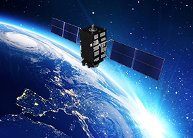
Quasi-Zenith Satellite System MICHIBIKI is a Japanese satellite positioning system that uses signals transmitted by satellites to recognize location information. Since November 2018, the satellite family MICHIBIKI was deployed in four-satellite constellation, and development and improvement are underway to build a seven-satellite constellation. On February 2, 2025, the sixth satellite was launched, marking the first step toward the establishment of a seven-satellite constellation in 2026.
At present, three of the four satellites can be seen at any time from Japan and the rest of the Asia-Oceania region. This system is specifically designed for this region. The other satellite has been always positioned near the zenith as seen from the ground in Japan, which enables highly accurate positioning.
“MICHIBIKI” is highly compatible with the Global Positioning System (GPS). Compared to using only the GPS, it is possible to achieve higher accuracy and more stable positioning, especially in mountainous areas and areas with many buildings. Currently, only the Japanese MICHIBIKI has this feature. By transmitting information (sub-meter level augmentation information*) from the satellites to reduce errors in satellite positioning, it is possible to achieve positioning with centimeter accuracy that is not possible with the GPS alone.
* “Sub-meter Level Augmentation Information” is additional information to improve location accuracy. (Source: “MICHIBIKI” website)
Future outlook for the applications of the Quasi-Zenith Satellite System MICHIBIKI
Businesses and services that utilize “MICHIBIKI,” by means of communication devices such as smartphones and tablet terminals, car products, and GNSS receivers, are gradually starting up.
Toward further practical application and wider deployment, various feasibility study experiments have been conducted in various fields, such as automobiles, aviation, civil engineering and construction, traffic safety, and disaster information, using location information obtained from “MICHIBIKI.”
YRP UNL has been being working to make it easier for anyone to achieve precise location measurement by utilizing embedded devices that use µT-Kernel, which is widely deployed as a real-time OS for embedded systems in these fields.
Therefore, YRP UNL has cooperated in the design and development of the API for the library middleware that performs position measurement using “MICHIBIKI” in the TRON Forum WG.YRP UNL hopes to see the use of “MICHIBIKI” expand in the future.